


.jpeg)


With the arrival of warmer weather, the desire to venture into nature grows stronger. Embracing hiking, an activity filled with immense benefits, becomes irresistible.
Harnessing the power of our smartphones as essential tools for hiking, we uncover optimal trails through specialized apps, ideal for planning weekend escapes. This week, Kenia Outdoor guides you through the top 7 apps designed for hiking and outdoor adventures.
.
.
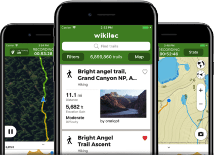
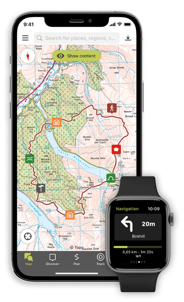
1. Wikiloc
Wikiloc, a free app highly recommended by professionals and enthusiasts alike, often praised as the premier hiking application.
You may be wondering, what makes Wikiloc stand out? Well, it has over 32,000,000 routes worldwide, all provided by app users, guiding us through paths that even GPS has not discovered yet.
Through its 'Explore' section, Wikiloc helps us find the perfect route tailored to our needs. By using filters to uncover details like distance, elevation gain, and difficulty the perfect path is just a click away.
What's truly impressive is its ability to record our hikes, allowing us to share them with other users while tracking distance, average speed, active time, and elevation gain. It also offers offline maps—an essential feature for remote mountain areas.
Start sharing your adventures with the use of Wikiloc and venture out into the world of the unknown. Who knows, you might find your new favorite spot using Wikiloc!
.
.
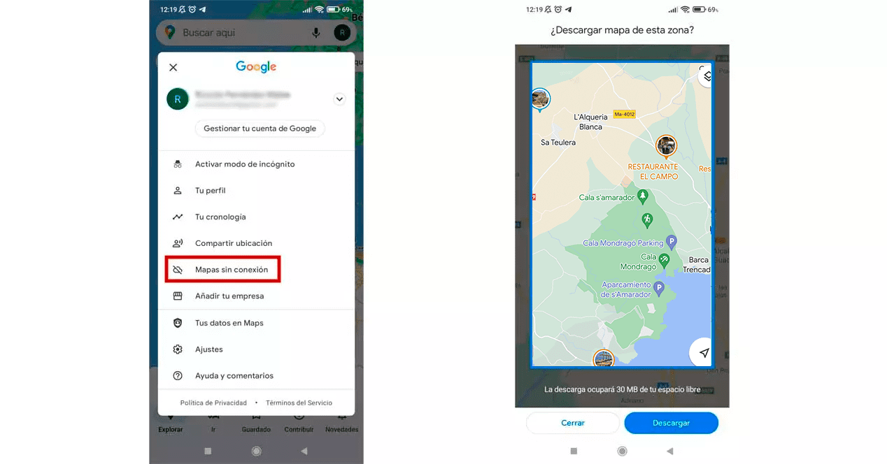
2. Google Maps
Google Maps stands as an essential navigation app that every hiking enthusiast carries on their mobile device.
For Android users, this app comes pre-installed, ensuring easy access to essential features. If you're not an Android user, we highly recommend downloading it as it may guide you on your next journey.
This versatile application allows you to pinpoint your exact location at any moment and thoroughly explore your surroundings on the map.
Not to mention, you can save your history and favorite spots, download maps for offline use, and even create custom maps featuring your preferred routes.
.
.
Furthermore, when near a landmark or significant attraction, you can investigate the details or information by viewing real user photos, and explore its unique features.
.
.
.
3. Outdoor Active
This incredible app offers over 150,000 tours available year-round, with elevation profiles, maps, and even GPX tracks.
Outdoor Active identifies areas ranging from cabins to ski resorts, peak finders, and detailed weather conditions for specific hikes or tours. As a bonus, the app allows you to download all tours and hikes for offline use.
And that's not all—it also features a compass, altimeter, emergency call button, original maps, sharing modes, and full-screen display for an enhanced outdoor experience.
.
.
4. AllTrails
AllTrails stands out as a must-have app for hiking and cycling, offering incredible usage by helping you discover intriguing paths and explore camping areas.
Ideal for uncovering trails worldwide, AllTrails features various filters for adjusting searches by difficulty, distance, elevation, or ratings. Its free version includes guided navigation and the ability to save your favorite routes.
In addition to precise route directions, it offers multiple customization options and a very affordable PRO version.
Hikers often debate between AllTrails and Wikiloc. While both apps share similarities, the choice often boils down to personal preference, app design, and specific features. The decision is yours to make!
.
.
5. IGN – Mapas
Mapas de España is the official and free app from the National Centre for Geographic Information, offering maps from the National Geographic Institute. It's also known as the free version of OruxMaps.
This app allows you to plot routes, save them, calculate distances, and view maps offline. While it may not be the most advanced, it's perfect for beginners with all the essential features.
You can open and save routes in GPX, KML, and KMZ formats. It works offline and includes shortcuts to download routes from National Parks, greenways, or even stages of the Camino de Santiago.
.
.
.
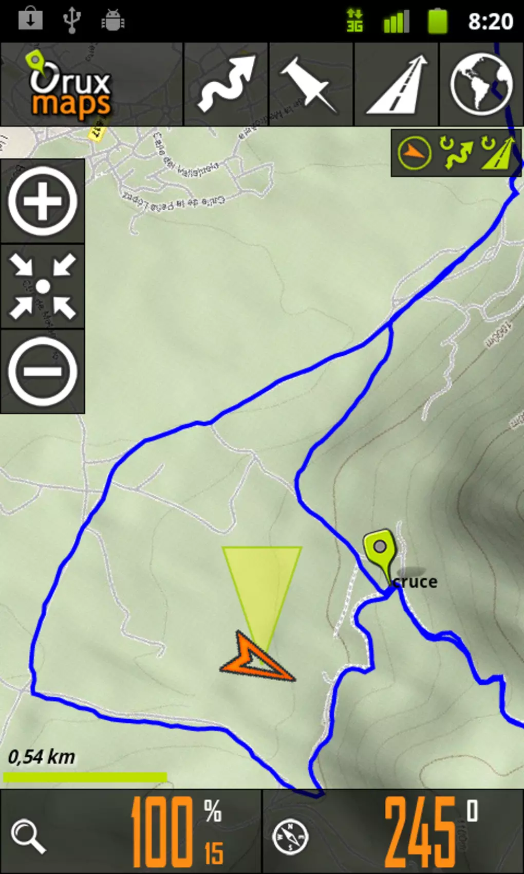
6. Orux Maps
OruxMaps stands out as one of the most inclusive yet challenging-to-master apps available. Its extensive feature set includes map creation, KML and GPS route viewing, offline maps, multitracking capabilities, and an SOS function.
While it's a paid app, it offers excellent value for every penny spent, those seeking a simpler, more intuitive experience might lean towards Wikiloc instead. Wikiloc provides a user-friendly alternative without compromising on essential features, making it a preferable choice for those prioritizing ease of use in their outdoor adventures.
.
.
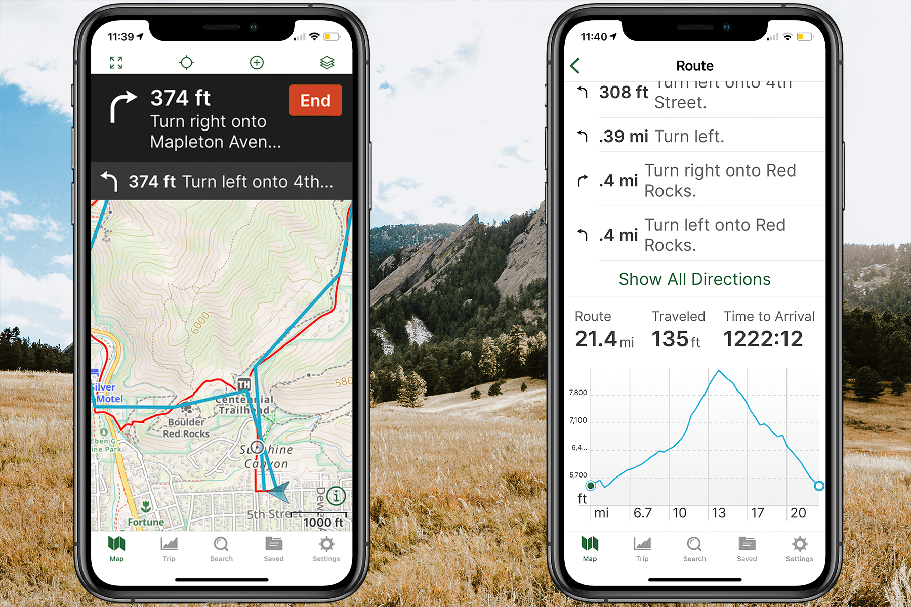
7. Gaia GPS
Finally, we introduce you to Gaia GPS, the only topographic mapping app compatible with Android Auto, allowing you to use its free guided navigation on dirt roads that other GPS navigators may not cover.
Gaia GPS features a section for discovering popular routes, recording trips, or manually creating our own routes directly from the mobile app, with voice-guided GPS navigation along chosen paths. While the app itself is free, accessing some additional features requires a nominal annual fee, which is quite affordable.
.
.
.
.
We hope these recommendations prove useful for enhancing your mountain getaways. If you're interested in learning more about climbing gear or head mountain accessories, visit our online outdoor shop, Kenia Outdoor. We look forward to seeing you there!
- today
- perm_identity Kenia Outdoor
- label Viajes
- favorite 7 likes
- remove_red_eye 18451 views
- comment 0 comments
Comments (0)