


.jpeg)


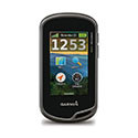

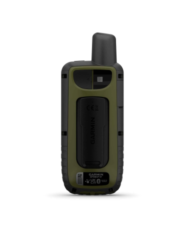
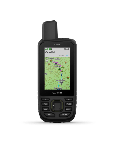
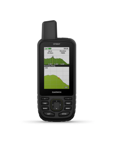

The Garmin GPSMAP 67 is a rugged, high-quality handheld device.
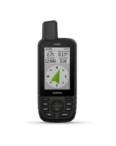
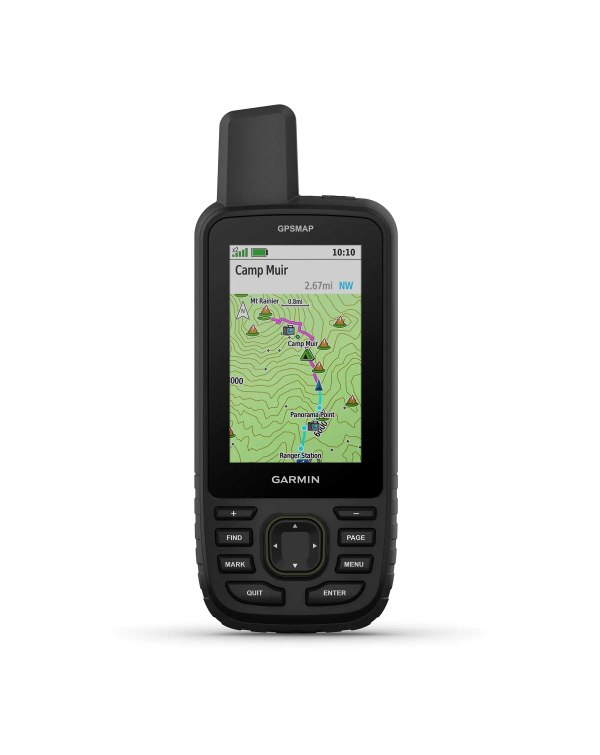
Enjoy long battery life, with up to 180 hours in tracking mode and 840 hours in low power, and multi-band technology for greater accuracy, plus pre-installed TopoActive mapping and access to satellite imagery. View your route clearly on the sunlight-readable 3″ colour display. Track your position in challenging conditions thanks to multi-band technology and extended GNSS compatibility. See the terrain you'll be travelling over with crisp satellite imagery that downloads directly to your navigator. Stay on top of the weather forecast with active weather on your route when paired to a compatible smartphone.
FEATURES
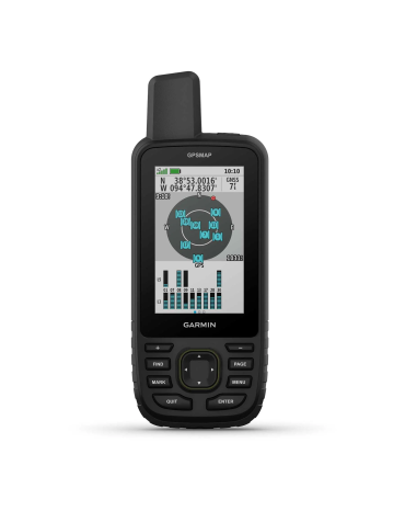
Access multiple global navigation satellite systems (GPS, GLONASS, Galileo and QZSS). Access multiple frequencies sent by navigation satellites to improve position accuracy in areas where GNSS signals are reflected, weak or normally do not penetrate.
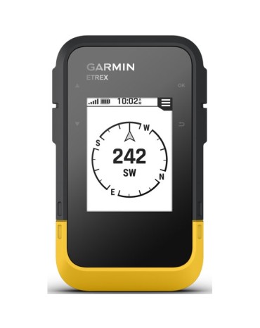
Use ABC sensors on every run; they include an altimeter for altitude data, a barometer to monitor weather changes and a three-axis electronic compass.
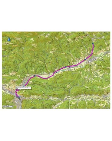
Download realistic, high-resolution maps directly to your device via Wi-Fi technology. Easily find routes, choose locations to stop and park, create waypoints and much more.
Pre-installed TopoActive Europe maps show summits, parks, coastlines, rivers, lakes and geographical landmarks.
With a subscription to Outdoor Maps+, you'll get information on public lands, landowner names, state land maps, game management unit boundaries, BLM boundaries and more.
This handheld device is designed to military standards for thermal performance, shock and water resistance (MIL-STD-810G), and is even compatible with night vision goggles.
The GPSMAP 67 series helps you avoid lugging around a lot of equipment, with a built-in LED torch that can be used as a beacon to pinpoint your position in case you need help.
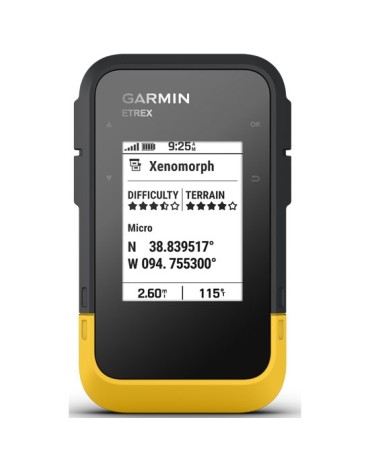
Get automatic cache updates from Geocaching Live, with descriptions, logs and tips. When connected via Wi-Fi or to the Garmin Explore smartphone app, each search will be uploaded to your Geocaching.com profile.
When you connect to the Garmin Explore smartphone app, you'll get real-time forecasts to stay on top of changing conditions.
Plan, review and sync waypoints, routes and tracks with the Garmin Explore website and app. You can even review completed activities in the field.
The internal rechargeable lithium-ion battery provides up to 180 hours of battery life in GPS mode and up to 840 hours in low-power mode.
Physical and performance specifications:
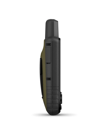
Dimensions: 6.2 x 16.3 x 3.5 cm
Display size: 3.8 x 6.3 cm
Display resolution: 240 x 400 px
Display type: Transflective TFT colour display
Weight: 230 g (with batteries)
Water resistance: IPX7
Battery: Internal rechargeable lithium-ion battery
Battery life: Up to 180 h (default mode), up to 840 h (low power mode)
MIL-STD-810: Temperature, shock, water; unit only, no accessories
Interface: USB-C
Memory/History: 16 GB (user space varies depending on maps included)
Connectivity: Bluetooth, Wi-Fi, ANT+
Maps and memory:
Pre-installed maps
Ability to add maps
Base map
Automatic route creation
Map segments: 15,000
Birdseye
Includes highly detailed hydrographic features
Includes points of interest searches
Displays national, regional, local parks, forests and wilderness areas
Compatible with 32 GB max. microSD card
Waypoints: 10,000
Trips: 250, 200 waypoints per trip
Tracks: 250
Activities available
Routes: 250, 250 points per route; 50 points for automatic routes

Data sheet
Specific References
The Garmin GPSMAP 67 is a rugged, high-quality handheld device.